Google Maps has become a widely used application in our daily lives, but that does not mean that everyone has it up to date or that they use it regularly. To make a specific query or simply to start an improvised route, it is interesting to know how to quickly calculate the time it takes to reach a point without opening Google Maps . This trick is possible and you simply have to use the Google search engine or open your Google Chrome browser.
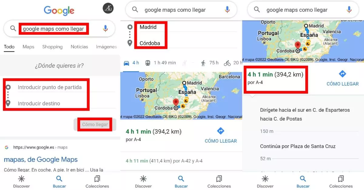
When entering the term ‘Google Maps how to get there’ in the Google search box, you will see how two extra boxes appear on your screen to enter both the point of origin and the destination. From there, just search and the app will show you how long it takes to get there, without opening Google Maps. Of course, be careful because even if the application does not open, that search will end up being reflected in your history when you open it again , so do not think that you can use this trick as a kind of incognito Google Maps.
If it is not a quest to clear up doubts and you want to start the route, you can display the indications of the same to start following them. You just have to click on the alternative you want on the left side (marked with a red square in the image), because if you click on ‘How to get there’, the Google Maps application will open. These instructions will not be indicated by voice as you drive, so you should not use it if you do not have a co-pilot who tells you where to go .

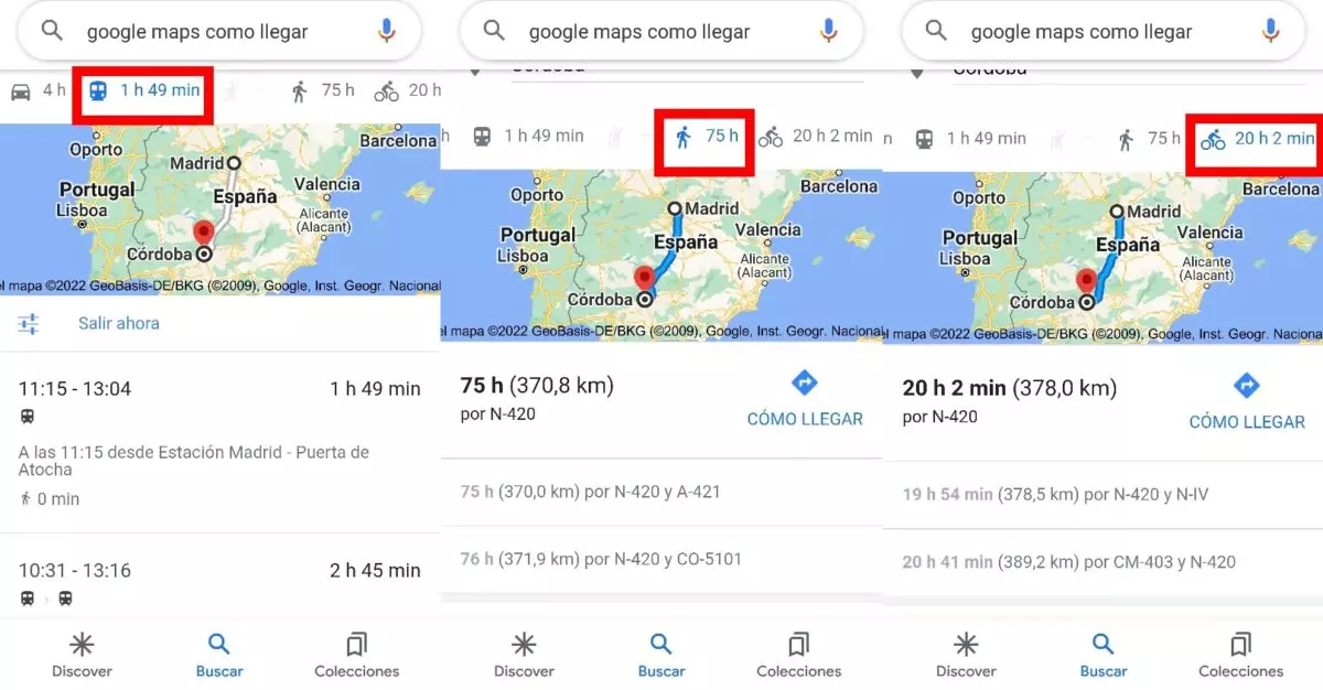
This function of Google Maps without having to open the application is not limited only to traveling by car. With that same search you can also check how long it would take to reach a specific destination by public transport, on foot or by bicycle, a very useful tool for specific or urgent queries. You will only have to click on the icons on the horizontal bar at the top that represent each means of transport to see the directions and the estimated time of arrival.

DISADVANTAGES OF NOT OPENING THE GOOGLE MAPS APPLICATION
This trick to know the distance and the time it would take to get to any specific city or address brings with it some inconveniences of not opening the Google Maps application . These searches do not take into account some of the filters that allow you to better configure your route to your destination, such as the inclusion or not of tolls.
In the same way, as has already been specified above, the navigation option to receive voice directions as you drive is not available through Google Chrome search, so it is simply a resource to know the time and directions to take superficially.
The personalized routes of Google Maps in the application have an advantage , and that is that they can be shared directly through other applications such as WhatsApp. This will allow your friends to know which way to go so as not to run into any tolls and thus prevent the trip from being more expensive than expected.
OTHER GOOGLE MAPS FEATURES
The app is getting deeper and deeper, and among other Google Maps features worth noting we recently wrote about the ability to write restaurant reviews. Other details such as knowing the intensity of the traffic thanks to the colors or the possibility of knowing the altitude at which we are above sea level are two more small samples of all the options that Google Maps makes available to us.