Google Maps is undoubtedly one of the applications that have made life easier for us in recent years. It is no longer necessary to carry paper maps or ask neighbors when we go to an unfamiliar place. Now the process is much simpler, and we only have to ask Google Maps: how to get from one place to another by car . This will allow us to obtain directions and even start navigation. To do this, we just have to follow these steps:
- On your phone or tablet, open the Google Maps app
- Enter the address of the place you want to go to or touch the place on the map
- At the bottom left, tap the Get Directions button
- Among the options that appear, choose Car
- To view the list of directions, touch the bar at the bottom that shows the duration and distance of the trip.
Although the most common is that we move by car, we also have the possibility of finding how to get to the sites on foot, by bicycle or by public transport . But keep in mind that the public transport option is only available in some cities.
HOW TO MAKE A ROUTE IN GOOGLE MAPS AND SAVE IT
If you think that you are going to go to a place that you have searched for again, it is likely that you are interested in knowing how to make a route in Google Maps and save it . If you want to store them to have them on hand when you need them, you have to follow these steps:
- On your computer (not possible on mobile), log in to My Maps
- Open or create a map
- Click Add Directions
- In the box on the left, write the start and end directions
- The route will appear on the map and will be saved
Even if you have to do this process from your computer, then you can check the routes that you have saved from your mobile phone .
To do this, in the Maps application, you will have to enter the Saved section . At the bottom right you will see a button that says Maps. By clicking on it you will be able to find all the maps that you have created with My Maps. If you have a lot of saves, it may be worth making lists of favorites to make it easier for you to find them later.

HOW TO KNOW WHERE I HAVE PARKED MY CAR WITH GOOGLE MAPS
One of the functions of this application that are most useful for many people is the one that tells us how to know where I have parked my car with Google Maps .
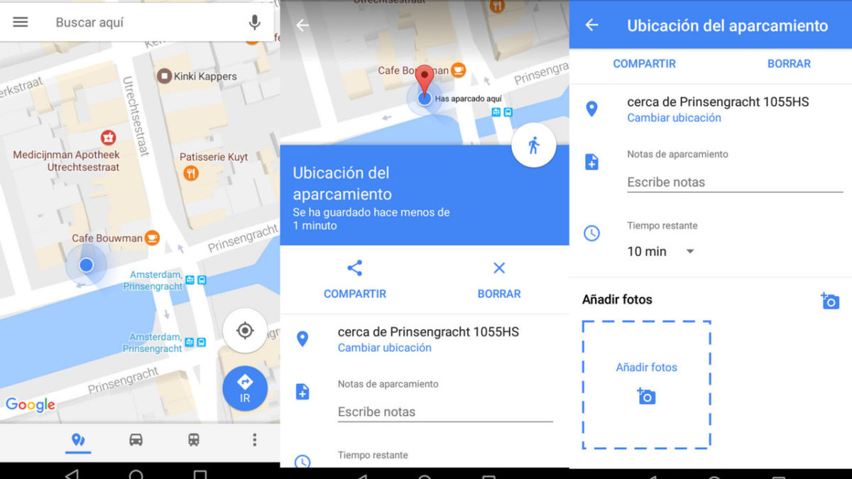
And this tool has a function that allows you to save the place where you have parked , so that you never get to “lose” your vehicle. In order to easily find your car wherever it is, you have to follow these steps:
- Open the Google Maps application on your mobile phone
- Tap on the blue dot where your current location is indicated
- In the menu that appears, tap Save parking
The moment you want to go back to your car, open the app and, in the search bar, select Parking location . The application will mark you on the map where your car is, so that you can easily return to it. If you wish, when you save it, you can even add photos to help you find the vehicle easily later.