If you are one of those people who gets lost easily, who can’t find the place they want to go to and who gets disoriented: you need to use this application. So take note of how to use Google Maps to walk the streets and save yourself more than one lap without knowing where you are.
If you thought that this Google app was only used to drive from one place to another, you were not right. It is also a very practical guide for walkers! Sight:
Contents
HOW TO USE GOOGLE MAPS TO WALK THE STREETS
Knowing how to use Google Maps to walk the streets is as simple as if you are going by car, you will simply have to choose the appropriate option among those offered by the application . And, yes, you must have internet access, so that you can calculate the route. Another important thing: connect your phone’s GPS. With that done, you already have a lot of cattle!

HOW TO ACTIVATE WALKING MODE IN GOOGLE MAPS
Once you enter the application and you have activated the GPS, we are going to tell you how to activate the walking mode in Google Maps and you will see that it is very easy. To do this, we are going to give you a real example, and that you can see it step by step:
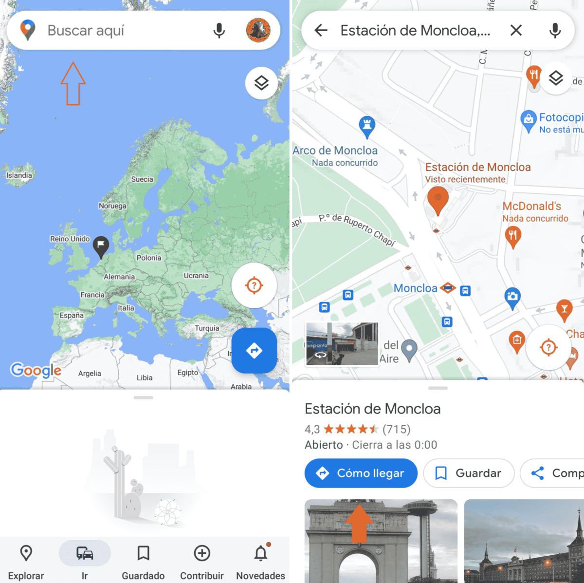
- Enter the application .
- In the top search bar, enter the place you want to go.
- By default, possibly, you get the option to go by car.
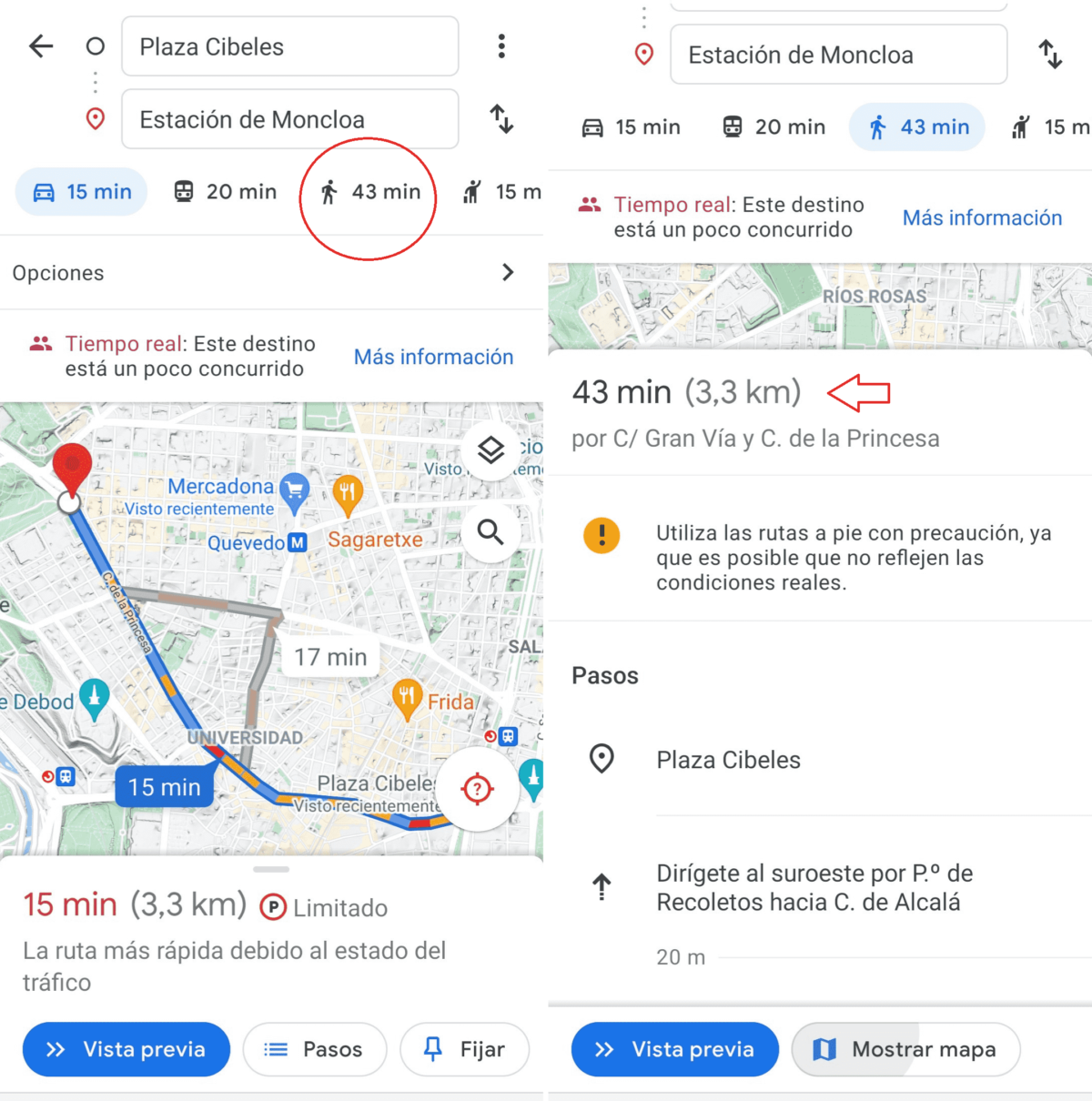
- Locate the doll, as we show you in the image, and press it.
- After entering the departure address (usually your location), you will see the route marked on the map.

HOW TO CALCULATE A WALKING ROUTE ON GOOGLE MAPS
If you have reached the previous point, surely you already intuit how to calculate a walking route on Google Maps because, by entering two addresses, before pressing the “doll” you will have seen that it puts the minutes (and also the distance between both points). That’s how long it will take to get from point A to point B.
You can also calculate a route before starting your walk or walk. To do this, enter both directions and press the doll icon again, so you will know how long it will take.
HOW TO KNOW THE WALKING TIME ON GOOGLE MAPS

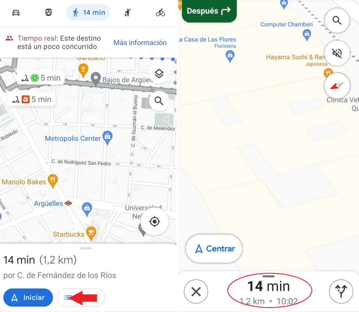
Finally, we are going to answer the question of how to know what the walking time is on Google Maps; As we have commented above, when you activate the walking mode in this application, the time it will take to do a certain path will appear. But it is, of course, an estimate, it is not the same to go in a hurry than taking a walk …
The app itself, as you walk, will tell you how much time you have left to reach your destination, and will recalculate it as you walk. If you are late … Look what Google “tells” you, and don’t resort to the classic “I’m here in 5 minutes”, if it’s 10, the application will tell you …