Getting lost when traveling is becoming a task with the alternatives available to us on how to get there on Google Maps : all options are covered, from traveling by car to using the public service. Each of these routes has its particularities and it is convenient to take them into account to plan our trips well and that no problem arises until we reach the destination.
Contents
HOW TO GET THERE BY CAR ON GOOGLE MAPS
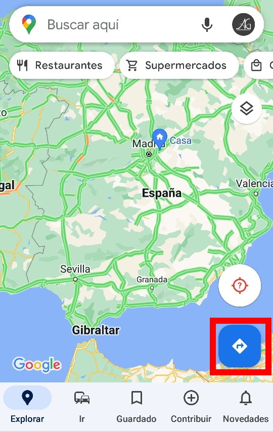
With the arrival of Easter, the most frequent search in the application will be how to get there by car on Google Maps , either to a nearby or remote destination. The blue button with an arrow to the right will allow us to enter the route that we have in mind, and the default search usually includes traveling by car unless our last query was for some other means of transport.
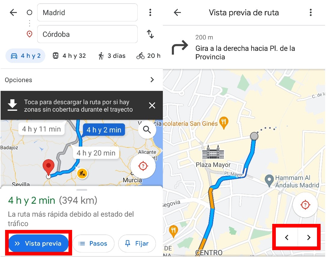
As soon as the search is done , Google Maps offers us the option to download the route , in anticipation of crossing areas with poor coverage that prevent the Internet connection from being stable. If we click on ‘Preview’, we will see the map with the last indication at the top of the app and the traffic intensity represented with colors. If we want to look at the next indication, at the bottom we have two arrows with which we can go forward or backward. This function will not be used during the trip.
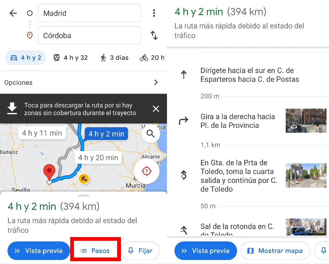
If we click on ‘Steps’, we will see all the indications in list format , with photographs of the area so that we have a visual reference. These photographs are usually more easily available in large cities and highways, being more difficult for them to appear in small towns or secondary roads.
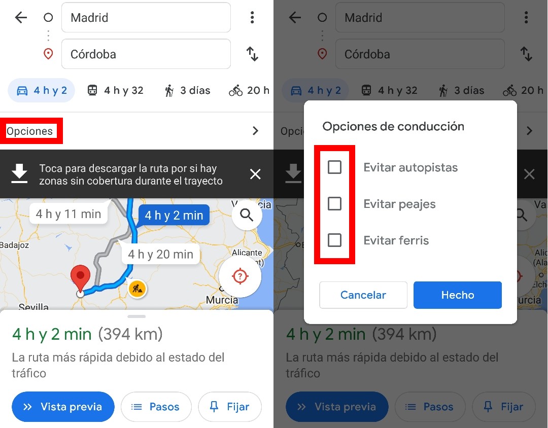
Returning to the main map, just below the estimated duration of the trip we will find an ‘Options’ bar, in which we can configure our route in greater detail . This function is highly recommended if we want to save money by avoiding tolls. Also available is the option to avoid highways, for those who love to travel on secondary roads , and to avoid ferries.
HOW TO GET THERE ON FOOT ON GOOGLE MAPS
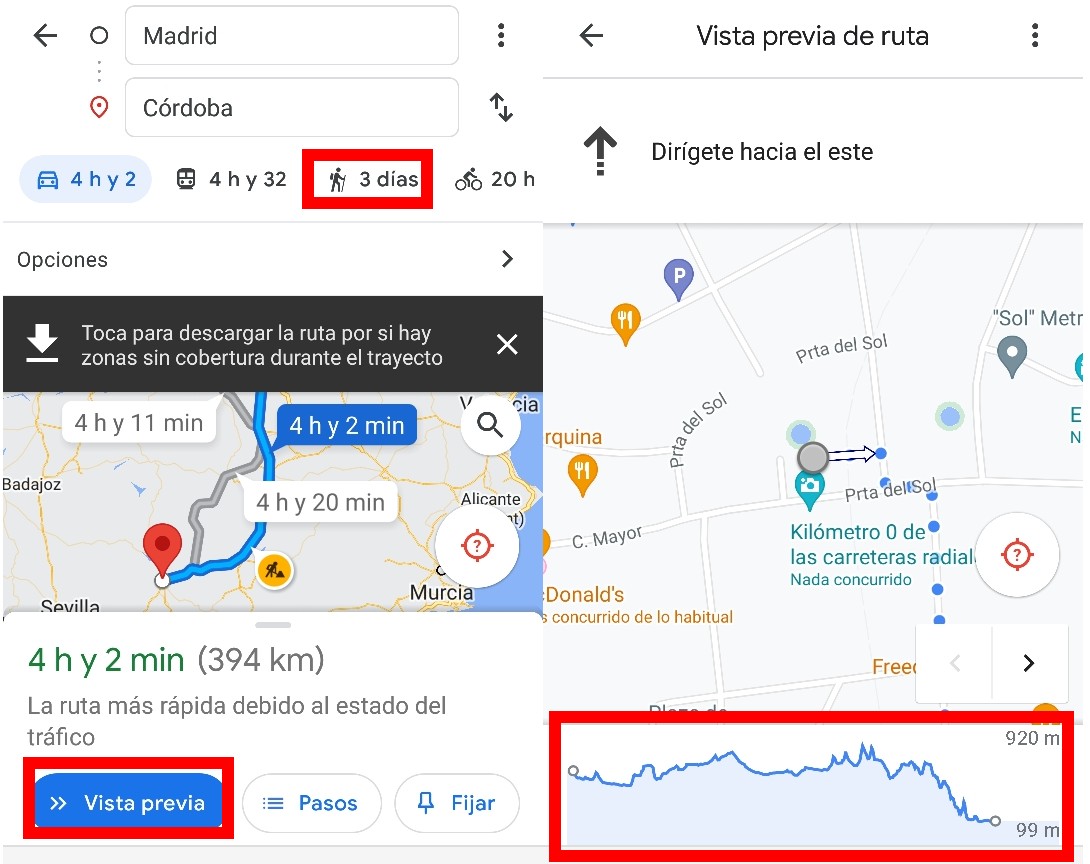
The design of the map varies slightly if what we want to know is how to get to another place on Google Maps . When entering a route, in ‘Preview’ we find again in the upper part the indication that corresponds to each moment, but in the lower part we will have an altimetry profile that will indicate how much difference there is between our origin and our destination.
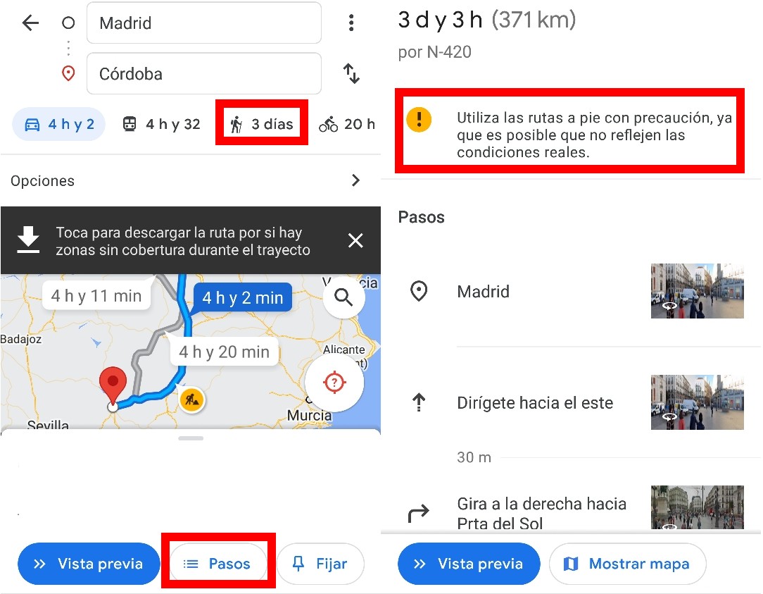
As in car trips, when you click on the ‘Steps’ button, all the indications will appear in the form of a list, but with the warning that the walking routes may not reflect real conditions . These routes are less reliable than those that measure the intensity of traffic, so we will not be able to know exactly if a space is very crowded or if a demonstration is organized to block the street, for example.
If we click on the icon with two overlapping diamonds that we will find on the right side of the application, we can choose how to view the maps. In addition to having at our disposal satellite or relief maps (highly recommended if we use the application for hiking), in the ‘Map details’ section we can also use the ‘Street View’ option so that Google Maps shows the photographs of the street and help us to better orientation.
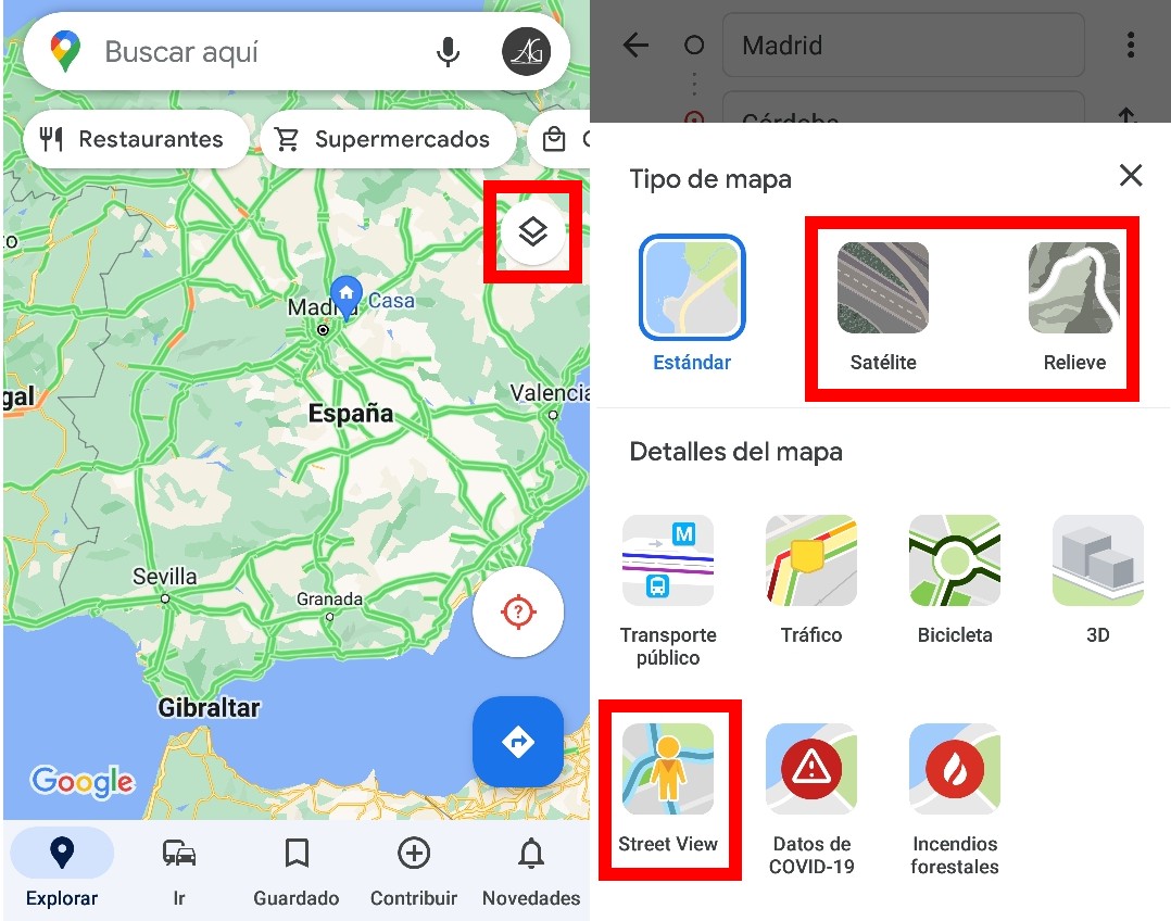
The walking routes of Google Maps are very interesting for short trips within the same city , especially if we are in a large city , since the amount of information on them is much greater than in a small town.
HOW TO GET THERE BY BIKE ON GOOGLE MAPS
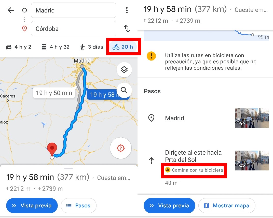
Bicycle lovers also have the possibility of knowing how to get to a specific destination by bike on Google Maps . To do this, you just have to press the icon with the bicycle that appears in the upper right, and we can see the distance that we will have to climb and descend before reaching our destination.
By clicking on ‘Steps’ we will also see, as in the two previous cases, the indications that we have to follow , but also with the warning of the sections in which we will have to use the bicycle while we walk , since we will be in pedestrian areas ( as the Puerta del Sol).
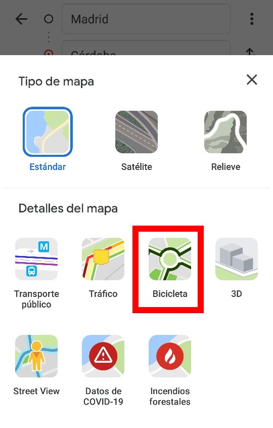
When clicking on the different types of map, we will find that in ‘Map details’ there is an option ‘Bike’ , but as it is a recent addition to Google Maps , it is likely that it will not work correctly on all devices yet. This map is designed to show the different bike lanes available in a city, so its use is reserved for large cities.
HOW TO GET THERE BY PUBLIC TRANSPORT ON GOOGLE MAPS
Finally, if we don’t want to drive, we can also check our route and find out how to get there by public transport on Google Maps . The public transport icon is located to the right of the car routes under the origin and destination text boxes, and it will offer us a wide variety of filters so that we can discover which route is the most convenient for us to use to reach the destination. wanted.
The first filter that we will have to introduce will be the departure time . The great information collected by Google in the application will help us to know what times we have available for the transfer with a very high reliability.
We can also select which means of transport we want to use , from the bus or the train to possible connections by car or with a BlaBlaCar-style service. Again, Google Maps adapts to all the route designs you can imagine.
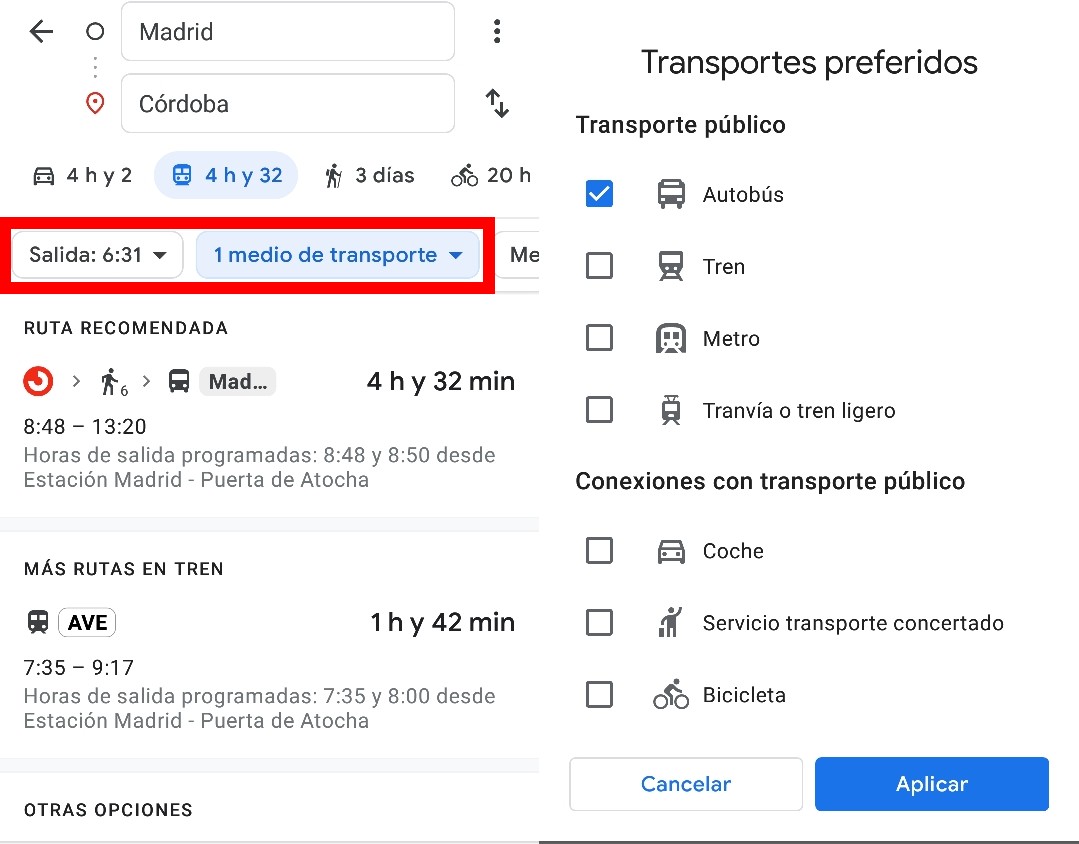
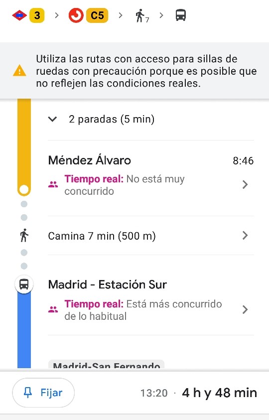
In ‘Route options’ we can select if we want the fastest one, the one with the fewest transfers for greater comfort and even a route adapted for users who have to travel in a wheelchair . This last alternative does not always respond to reality, so it is advisable not to rely too much on the indications, since there may be some stations that are not 100% adapted or that are carrying out maintenance tasks on the exits for people in wheelchairs. , which can be an added difficulty.
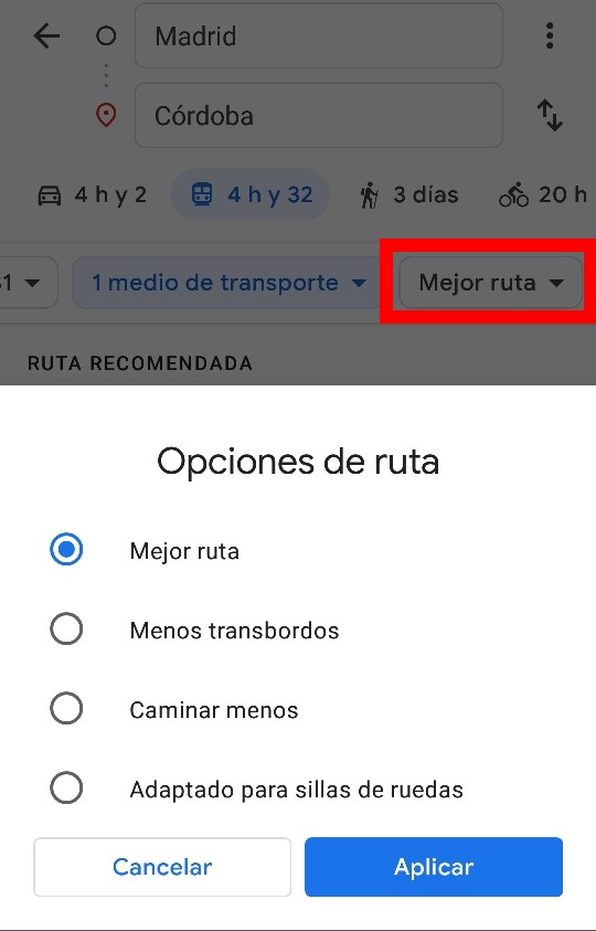
When configuring our route, we will see in the application the steps to follow and the updated information in real time in the main stations. The detail with which Google Maps guides users about the type of transport, the duration of the transfer and the influx of people at the station at that moment has not stopped increasing over time.
