For those who are not oriented very well, travel a lot or are all day from here to there, the Google Maps Spain application and all the ways to view maps can be very useful and interesting. But it is true that if you have not used or do not know how to use the app, having it or not is the same … Therefore, we are going to tell you step by step what are the ways to view maps and what situations each one is for.
Contents
GOOGLE MAPS SPAIN: ALL THE WAYS TO VIEW MAPS
But before getting fully into Google Maps Spain and all the ways to view maps, the first thing you have to do is locate your application. Like the rest of the Google apps, they usually come already installed on the phones, and you will find it in the Google applications folder.
You also have to know that, of course, for it to work, you must have the location activated . Knowing this, we started!
GOOGLE MAPS SPAIN: HOW TO GET THERE
With the Google Maps Spain application, how to get to the sites is very easy , you just have to follow the following steps:
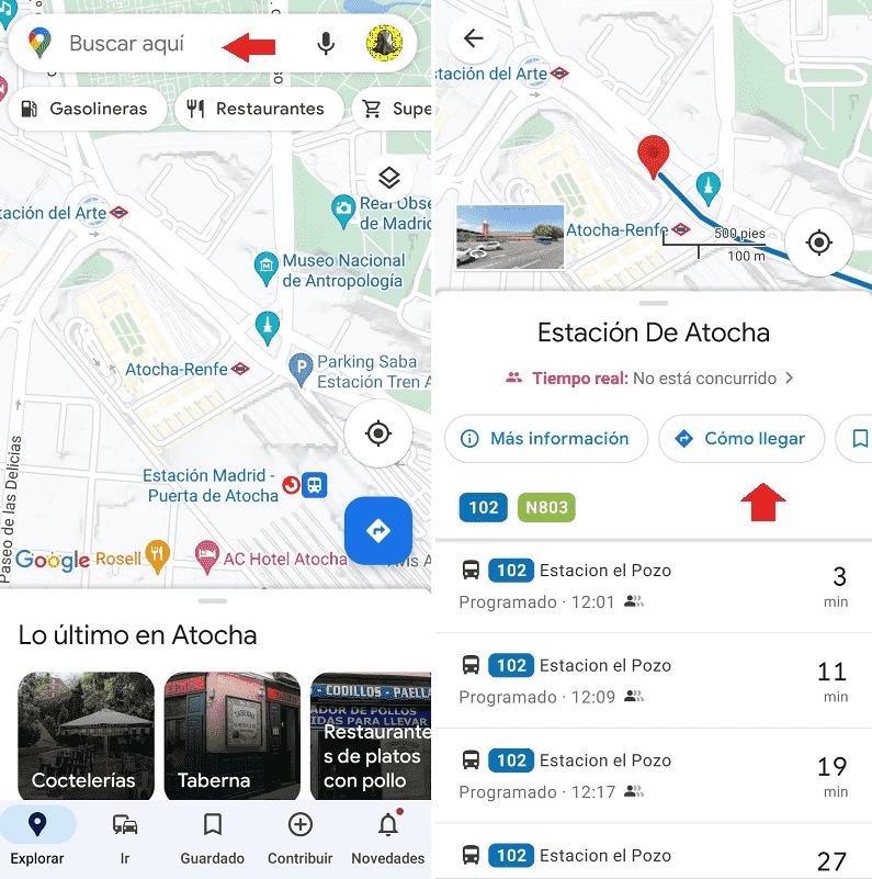
- Enter the application and in the top bar put the address you want to reach.
- Then click on the option “How to get there” (indicated in the following image with an arrow).

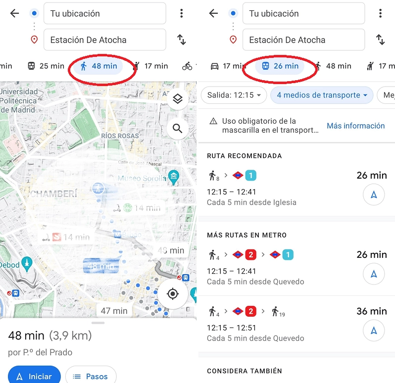
- The application will search for the best route to choose it should give you a clue of how you want to reach: that is, by public transport, walking, and n car … To give a tour appears based on that, as you can see in the imgagen.

GOOGLE MAPS SPAIN: HOW TO SEE MAPS WITH SATELLITE VIEW
Let’s say that you have already learned how to get to the site, but you want to see the map in another way, there is no problem in Google Maps Spain, seeing the maps with a satellite view is possible and it is as simple as following these steps:
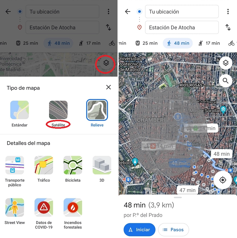
- Stay in the previous screen, when you have already viewed and calculated your route.
- Find the icon of the two overlapping squares, as seen in the image, and press it.
- Next, a drop-down will open with different types of map. You just have to look for the satellite view and press. Read on to see the difference between satellite and 3D!

GOOGLE MAPS SPAIN: 3D MAPS
Google Maps Spain and its 3D maps can cause confusion. Why? Well, because you will not see the image in three dimensions as if you were giving Street View or real view, but it is the traditional way of seeing the maps in the application.
To put the 3D format you just have to follow the previous steps and press 3D (instead of satellite). They are the maps that are seen in the images that accompany this text above. However, it is best to “play” with the different options so that you can choose the one that best suits your taste and your eyesight. And thus not to lose you again!